
Our Research High-resolution plant water stress monitoring
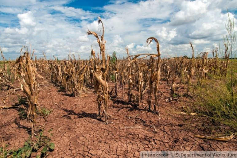
Corn shows the effects of drought in Texas on Aug. 20, 2013
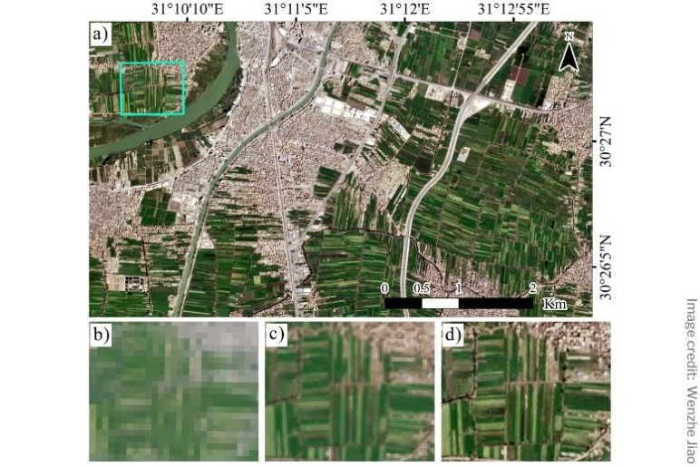
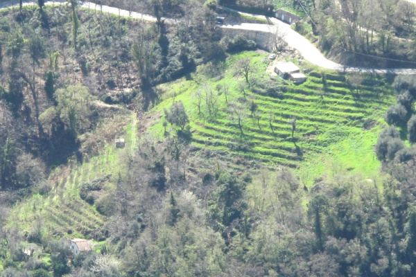
Natural color representation of an agricultural area along the Nile River near Banha, Egypt
Corn shows the effects of drought in Texas on Aug. 20, 2013
Natural color representation of an agricultural area along the Nile River near Banha, Egypt
Principal Investigator
César Terrer
- Assistant professor
- Department of Civil and Environmental Engineering
Professor César Terrer is a tenure-track assistant professor in the Department of Civil and Environmental Engineering at MIT. An expert in climate and carbon-cycle science, his research focuses on understanding and mitigating the impacts of climate change on terrestrial ecosystems. Professor Terrer has authored numerous high-impact publications, including articles in Nature and Science. He has also served as an advisor for large corporate entities on natural climate solutions. His work is recognized for its significant contributions to both scientific understanding and practical climate solutions.
Challenge:
How can satellite images be used to provide a high-resolution drought monitoring system for farmers?
Research Strategy
- Leverage new generation of remote sensing satellites to test and refine models for plant water stress monitoring
- Fuse multi-sensor remote sensing observations and eddy covariance flux data to produce plant drought stress assessments in high temporal and spatial resolution
Project description
Drought is recognized as one of the world’s most pressing and costly natural hazards, with direct impacts on vegetation that threaten water resources and food production globally. However, assessing and monitoring the impact of droughts on vegetation is extremely challenging as plants vary across species and ecosystems in their sensitivity to water deficits. In recent years, new remote sensing satellites have begun to collect data at a high spatial and temporal resolution, capable of capturing plant drought information at intra-field level.
This project leverages a new generation of remote sensing observations to provide high-resolution plant water stress at regional to global scales. The aim is to provide a plant drought monitoring product with farmland-specific services for water and socioeconomic management. This project also aims to provide the first quantitative and comprehensive evaluation of the spatiotemporal dynamics of vegetation drought response under climate change. The accurate and timely global drought detection and drought impact maps from this project are expected to assist land and water resource managers in drought mitigation planning. The project will also enhance our understanding of global carbon-water-energy cycle responses to drought.
News

Additional Details
Impact Areas
- Water
- Food
- Climate & Sustainability
Research Themes
- Sensors & Monitoring
- Sustainability & Adaptation
- Modeling & Data Analytics
Year Funded
- 2022
Grant Type
- Seed Grant
Status
- Ongoing